Your Privacy Choices
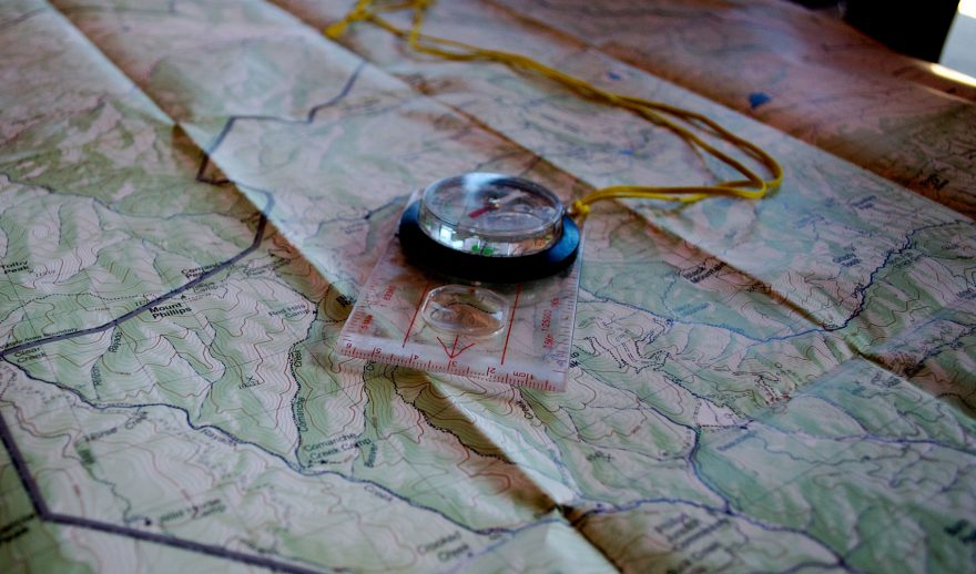
In the age of advanced technology, the debate between paper maps and digital navigation tools like handheld GPS devices has become common among hikers. There’s a timeless charm and reliability associated with paper maps that no digital alternative can completely replace — including a couple of main uses for a physical “paper” map: reliability and a connection to the land.
While you need to rely on a stable internet connection or a battery powered device (if you have downloadable map capabilities) for GPS and digital maps, for paper maps, you just need the map in hand. In remote wilderness areas, where cell signal is often nonexistent and long travel, cold weather or lack of sun could negatively impact charging devices, a paper map becomes an indispensable tool, ensuring you’re never left stranded in the middle of nowhere.
There’s also a unique satisfaction in unfolding a paper map and visually tracing your route with your finger. Paper maps give you a tangible connection to the landscape, allowing you to comprehend the topography and surrounding features in a way that a digital screen can’t replicate. The physical act of interacting with a paper map can enhance your spatial awareness and connection to the environment.
Here, we dive into five key tips for reading trail maps as a beginner, intermediate or advanced hiker.
1. Understand Map Symbols and Legends
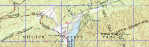
Trail maps are covered with symbols and legends that convey crucial information about the terrain. Familiarize yourself with these symbols to decipher details such as elevation changes, water sources, and landmarks. Among the more basic ones, for instance, are that a contour line indicates changes in elevation, while a blue line represents a water feature. Other symbols, however, get more complicated, like differentiating between a park boundary and overhead transmission lines. Understanding these symbols will significantly enhance your ability to interpret the map accurately.
If you’re heading out with a map, consider looking over this piece on learning how to excel at map reading, with tips from a search and rescue expert.
2. Identify Key Landmarks
Orient yourself by identifying prominent landmarks on the trail map and matching them with the actual terrain. This could include mountain peaks, lakes, or distinctive rock formations. By correlating what you see on the map with what’s in front of you, you’ll develop a mental map of the area, making navigation more intuitive. For example, if your map shows a distinct fork in the trail leading to a lake, use that as a reference point during your hike. When you come to that fork, you’ll know you’re on the right path and you’ll know how much longer it’ll take you to that lake.

3. Grasp the Contour Lines
Contour lines are powerful tools for understanding the topography of the land, especially in mountainous areas where elevation gain can come quickly. Remember, closer lines indicate steep terrain, while widely spaced lines signify a gentle slope. By grasping the contour lines, you can anticipate the difficulty of the terrain ahead and plan your route accordingly.
For example, if you encounter closely spaced contour lines on the map, expect a challenging uphill climb. As you likely know, it’s a good idea to have a “preventive maintenance” mindset while hiking. If you’re approaching those closely layered contour lines, you may want to fuel up or hydrate before you ascend. This could also be a great time to break out your hiking poles, tighten your boot laces and re-secure your pack to be as successful as possible while climbing.
4. Utilize Distance and Scale
Pay attention to the distance scale on the map to estimate how far you’ll be traveling. Combine this with trail mileage markers to gauge your progress accurately. For example, if the map scale indicates that one inch represents a mile, and you’ve covered three inches of the trail, you’ve hiked approximately three miles. You can calculate your distance per mile and judge things like weather and sunset to make sure you’re staying within conditions that meet your level of hiking experience. Knowing the distance scale can also help you plan breaks, estimating arrival times, and ensuring you stay on track.

5. Consider Trail Difficulty Ratings
Many trail maps include difficulty ratings for different sections of the route. These ratings provide insights into the challenges you might encounter, such as steep ascents, rocky terrain, or river crossings. Take note of these ratings to prepare mentally and physically for what lies ahead. For example, if you encounter a section marked “difficult” on the map, this could prompt you to take extra precautions and be prepared for a more strenuous hike. This could also prompt you to take an alternative route around a challenging obstacle if that more closely aligns with your skill level.
In the realm of outdoor adventures, the ability to read a trail map as a beginner, intermediate or advanced hiker is a fundamental skill that enhances both safety and enjoyment. Mastering the interpretation of map symbols, landmarks, contour lines, distance, and difficulty ratings opens a world of exploration.
While digital maps and GPS devices have their merits, the enduring benefits of paper maps lead the pack in their reliability, tangible connection to the landscape, and essential role during emergencies.
So whether you’re navigating dense forests, ascending rugged peaks, or traversing open meadows, a well-read trail map is your trusted companion, ensuring you stay on course and make the most of your hiking experience.
Suzanne Downing is an outdoor writer and photographer in Montana with an environmental science journalism background. Her work can be found in Outdoors Unlimited, Bugle Magazine, Missoulian, Byline Magazine, Communique, MTPR online, UM Native News, National Wildlife Federation campaigns and more.