Your Privacy Choices
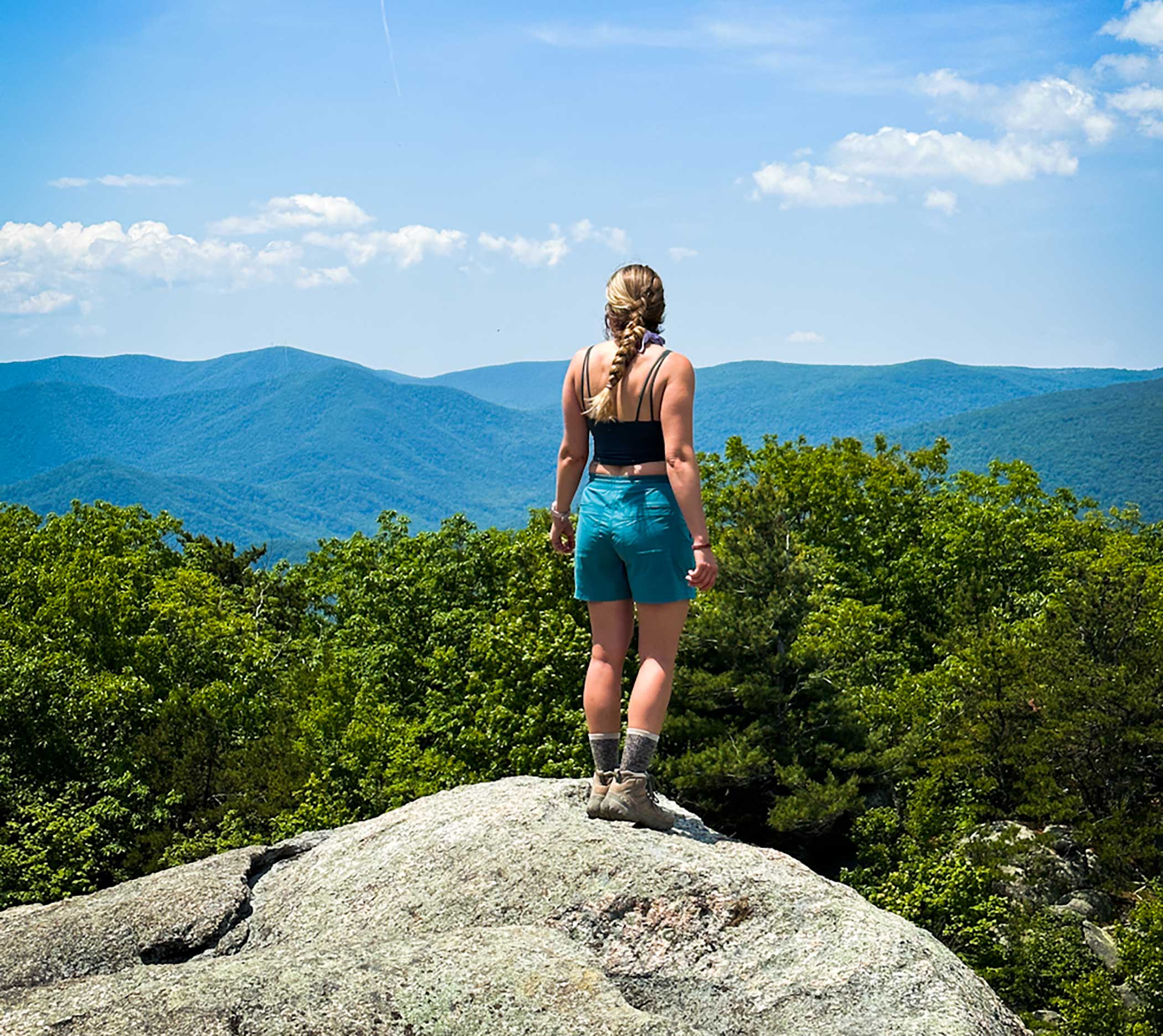
The view atop Old Rag in Shenandoah National Park (Image courtesy of Kris Maria)
Did you know Shenandoah National Park was ranked the BEST National Park to visit in 2023 by Travel Lemming? The online travel guide ranked all 63 National Parks based on factors like crowds, weather, accessibility, affordability and biodiversity, and Shenandoah came out on top.
For a frequent visitor such as myself, this news is no surprise, but for those less familiar with the park, it might be shocking! With over 500 miles of hiking trails through all types of terrain, Shenandoah has some of the best hiking in the Eastern U.S. What’s better: Shenandoah is just over 75 miles from Washington D.C., and with its many charming gateway towns like Front Royal and Luray, it’s an easy and affordable place to visit.
If you’re heading to Shenandoah National Park this summer (or ever), here are 7 of the best hikes to add to your list.
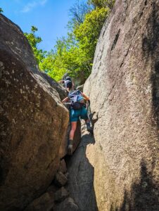
Old Rag (Image courtesy of Kris Maria)
1. Old Rag Mountain
You can’t talk Shenandoah without mentioning Old Rag Mountain. This is simultaneously the most popular and the most challenging hike in Shenandoah National Park (some would say in all of Virginia). The loop hike clocks in around 9.5 miles with a total elevation gain of 2,500 feet. The difficulty is mostly attributed to the 1.5-mile rock scramble to the summit.
It’s a technical challenge that most certainly involves the use of all four limbs. As long as you have a decent level of physical fitness and prepare appropriately, it’s a fun day hike! Please note a day-use ticket is required for this hike between March and November.
White Oak Canyon (Image courtesy of Kris Maria)
2. White Oak Canyon and Cedar Run Loop
This might be the second-most challenging hike in the park, but another epic day hike if you have it in you! If not, you can break the loop into two separate hikes and tackle one at a time.
The major draw to both White Oak Canyon and Cedar Run Trails is the plethora of waterfalls you’ll encounter. White Oak Canyon Trail runs from Skyline Drive down to the lower parking lot on Weakley Hollow Road (roughly 3 miles point to point), passing 6 sizeable waterfalls. The incline is slightly gentler (though still challenging) than Cedar Run, so I recommend ascending on the White Oak Canyon Trail and descending on Cedar Run Trail if you plan to make a loop.

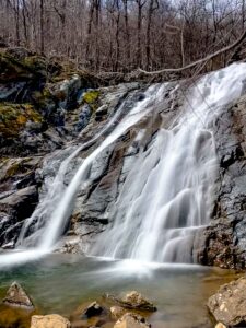
Cedar Run Falls (Image courtesy of Kris Maria)
I personally enjoy the Cedar Run Trail the most. It’s slightly steeper, but there are several beautiful swimming holes and even a natural water slide! You can ascend on this trail from the lower parking area to the water slide and then return for a 4-mile hike with roughly 1,000 feet of elevation gain.

Stony Man (Image courtesy of Kris Maria)
3. Stony Man Mountain
While Stony Man is the second tallest peak in the park (next to Hawksbill), it is my favorite for the incredible sweeping view of the Shenandoah Valley and Skyline Drive. The summit itself is very accessible from the Skyland parking area (.75 miles one way), making it a great choice for a sunset hike. My preferred route is a 3.5-mile loop via the Appalachian and Passamoquody Trails, as you’ll get great views along the way experience Little Stony Man summit.
Be sure to stop at Skyland Lodge after for the acclaimed blackberry cobbler!

Doyle’s River Falls (Image courtesy of Kris Maria)
4. Doyle’s River Falls and Jones Run Falls
Another waterfall hike, this 6-mile loop in the Southern District of the park really packs a punch. Like No. 2 on this list, you can separate this loop into two shorter hikes.
This set of trails surrounds hikers with beautiful greenery and abundant wildflowers in the summer months. The big highlights are Jones Run Falls and Doyle’s River Falls, which is actually a set of two waterfalls — upper and lower. Given its location in the southern district, you may find this hike less crowded than those in the northern and central districts.

Overall Run (Image courtesy of Kris Maria)
5. Overall Run Falls via Thompson Hollow
This waterfall hike clocks in around 6 miles out and back with two major features — Seven Pools and Overall Run Falls, which is the largest single drop waterfall in Shenandoah at 93 feet tall.
You’ll start outside the park from Thompson Hollow and hike about a mile to reach Seven Pools (a series of cascades and swimming holes). Then, you’ll briefly retrace your steps back to an intersection where you’ll turn right onto the Tuscarora-Overall Run Trail. Follow this trail up to the Overall Run Falls viewpoint, and you can continue upward to Upper Overall Run Falls if you wish. The last climb to the viewpoint of Overall Run Falls is very steep.
For an easier route to Overall Run Falls, try starting from Matthews Arm Campground.

Big Meadows (Image courtesy of Kris Maria)
6. Big Meadows to Rapidan Camp
This hike can be made into a variety of different loops or be completed as an out and back hike. Starting from Big Meadows Campground, you’ll hike past Big Rock Falls, continuing on to Rapidan Camp, otherwise known as Camp Hoover.
Camp Hoover was built by President Herbert Hoover and his wife in 1929 and served as their retreat throughout his administration. It was considered a National Historic Landmark in 1988 and restored in 2004 before being opened to the public (remaining open today). The exact route for this trail and more can be found on the SNP 52 hiking challenge website.

Mary’s Rock (Image courtesy of Kris Maria)
7. Mary’s Rock
This beautiful summit hike is located near the Thornton Gap Entrance Station, making it very convenient to access. There are several route options ranging from 3 miles to 6+ miles depending on the type of hike you’re looking for.
My favorite route in the 3- to 4-mile range is the Northern approach via the Appalachian Trail. You’ll gain over 1,000 feet in elevation, but quickly forget the pain once you see the sweeping views at the top. Another preferred route is roughly 6 miles out and back from Pinnacles Picnic Grounds. The elevation gain is similar, but the views along the ridge make for a more scenic hike. Don’t forget to drive through Mary’s Rock Tunnel — the only tunnel in Shenandoah National Park.
Hopefully you have a lot to think about for your next trip to Shenandoah! Be sure to check the official park website for the most up-to-date information (e.g., road or trail closures) and follow all principles of Leave No Trace so we can keep the park beautiful for generations to come.
Kris Maria is a hiking and travel blogger based in the Washington, D.C., area. Visit her website, krismariawanders.com, for more East Coast adventure ideas