 Your Privacy Choices
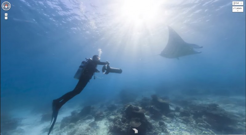
The wonders of the ocean will soon be available for all to view with the help of Google's newest project.
Scientists have long believed that the last frontier on earth is our oceans. Even with our current technology, underwater animals and habitats are still relatively clouded in mystery. But Google, in partnership with Catlin insurance and the U.S. government, is seeking to change that.
Recently, the companies unveiled their intent to expand the wildly popular Street View capabilities to underwater reefs. In cooperation with Catlin’s Seaview Survey and Global Reef Record, scientists will be diving deep beneath the water off the coast of the Florida Keys, hoping to provide a panoramic view of a world highly inaccessible to the masses.
“This allows people who can’t get underwater to understand what we mean by putting up a special preservation area around this particular spot,” Mitchell Tartt, chief of the conservation science division at the National Oceanic and Atmospheric Administration’s Office of National Marine Sanctuaries, told The Associated Press.
With the help of special basketball-shaped, triple-lens cameras, scuba divers are able to capture panoramic views 20 times larger than what has been previously available by simply pushing the device aided by a small, on-board motor.
According to project director Richard Vevers, scientists have already captured about 400,000 images of the reefs off the Australian and Caribbean coasts. After Florida, Southeast Asia will be next on the agenda, with scientists crisscrossing the globe, capturing as many images and supporting data as possible, until eventually completing a worldwide ocean view collection.
Though the ability to dive the Great Barrier Reef from the comfort of your couch will be amazing, the real significance of the project lies in the NOAA’s desire to create transparency about the underwater world. The data collected could also provide insight into the effects of global warming, pollution, and hurricanes on reefs. The NOAA is looking into using the technology for smaller projects as well, such as measuring the impacts of landslides, or the effectiveness of determined preservation zones.
For now, Catlin’s Global Reef Record will house the images until the new Google Oceans is ready for wide release. But you can still check out the teaser video of the project below:
Image and video courtesy Google Maps/YouTube