Your Privacy Choices
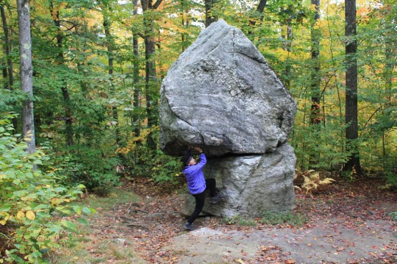
Hanging out under Balance Rock on the way to the Wachusett summit.
Editor’s Note: 50 Best Hikes in New England (Countryman Press) is a new book written by ActionHub columnist Marty Basch. We’ll occasionally be posting abridged versions of some of those hikes.
The highest Massachusetts mountain east of the Berkshires is only about an hour from Boston, so prepare to have some company when climbing Wachusett.
At 2,006 feet, the central Bay State landmark is located in the 3,000-acre Wachusett Mountain State Reservation. The summit yields outstanding views on those clear days all the way to the Boston skyline in the east and those lovely Berkshires to the west. Let’s not forget New Hampshire’s Mount Monadnock in the north too.
With about 17 miles of hiking trails, there are many ways to explore the mountain with its streams, fields, meadows, and forests. The mountain is a monadnock—basically a peak that rises from a surrounding flat area. There’s also plenty of evidence of glacial activity, particularly on the northeast side by Balanced Rock, two huge boulders piled on top of each other.
Part of a wide-ranging greenway area, Wachusett is a Native American word. There are those who believe it means “mountain place” while others say “the great hill.” Henry David Thoreau called it “the observatory of Massachusetts.” They’re all good.
The woods are also home to the biggest old growth forest east of the Connecticut River in Massachusetts with trees more than 350 years old. Bird watchers enjoy watching the hawks playing above in the thermals.
About four miles of the yellow-blazed Mid-State Trail, the 92-mile trail between Ashburnham and the Rhode Island border, runs through the reservation and reaches its high point.
The mountain also contains a seasonal summit road and the John Hitchcock Visitor Center with its worthy exhibits (and warmth on a cold day). Not only does it serve hikers, but in winter skiers and snowboarders fly down the 22 trails on the north side of the mountain. The first ski trails on the Wachusett were cut by the Civilian Conservation Corps in the late 1930s while the first chairlift, a T-bar, was installed in 1960.
The yellow-blazed Balance Rock Trail (part of the Mid-State Trail) leaves the ski area lodge parking area by the trailhead on a dirt road before a quick bend as it enters the woods and soon reaches Balance Rock at .4 miles. The rocks seem to defy gravity a bit. Maybe 20 feet high, it looks like they’re stacked on top of each other.
Continue past Balance Rock to the dirt Balance Rock Road and walk up the road about 150 feet to the 1.2-mile Old Indian Trail (a portion is part of the Mid-State Trail) as it ascends with more of a bite through the pine and hardwood forest, shortly crossing the junction with the Semuhenna Trail.
Stay with the Old Indian Trail as its blazes turn blue. The pathway crosses ski trails and passes under a ski lift, eventually coming to the summit road. Walk down the road maybe 50 yards and continue on the other side, crossing a brook bed and ascending to a junction with the West Side Trail. Zigzag some over a rocky section before leveling off to reach the summit with its towers.
At the summit, take in the almost 360-degree panorama that on a clear day means seeing Boston’s buildings in the east and the Worcester skyline in the south. The lake to the north at the mountain’s base is Wachusett Lake, while further on is the stony top of Mount Monadnock in the Granite State. Gaze to the east of Monadnock to spot Mount Watatic in Massachusetts edged by the New Hampshire border.
When you’ve had your fill of the mountain place on top, make your way back down the great hill to the trailhead along the same pathways to complete the 3.2-mile journey.
Image by Marty Basch