 Your Privacy Choices
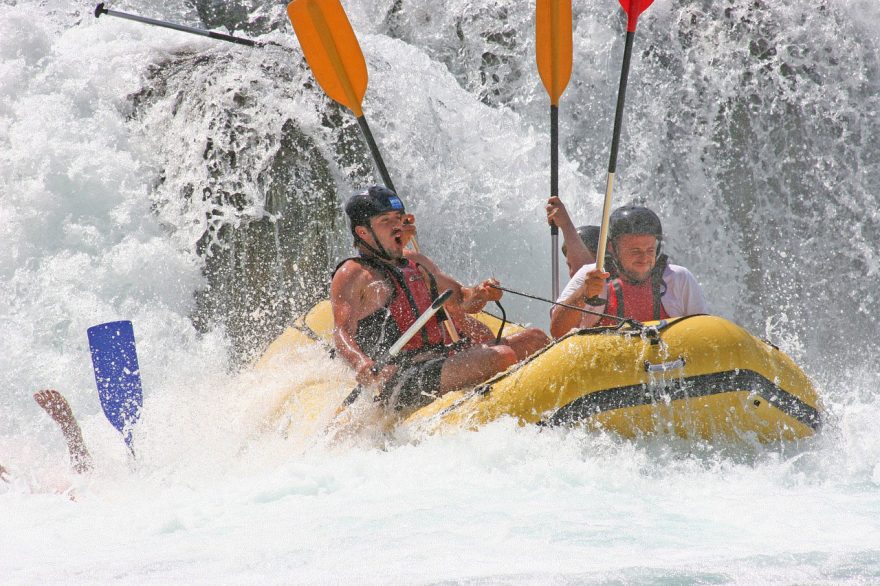
Outdoor recreational options are abundant in Kentucky, ranging from wild to mild. Practically anything you want to experience can be found in Kentucky, from spelunking in Mammoth Cave to horse farming, scaling sandstone cliffs or hiking wooded trails. And of course, rafting. There are countless streams and rivers for a great outdoor adventure in the Bluegrass State. Nature lovers will find their bliss amongst Kentucky’s sparkling waters, unspoiled wilderness, and rolling hills.
Whitewater rafting can look a lot easier than it is, as it can be a challenging sport, requiring skills to maneuver the raft and prepare for what’s coming ahead. Nature throws several obstacles at you while practicing this sport, in the form of waves, debris, fallen trees, rapids, drop offs, waterfalls and undercut rocks. The waterways are rated with Grades 1 – 6, one being the easiest and six being so dangerous it’s nearly impossible to navigate it with a raft safely, so it’s best left to the experts. Are you extreme enough to ride a Kentucky rapid? Read on for some of the best spots to practice rafting in Kentucky.
About Rafting in Kentucky
Nearly all of Kentucky’s whitewater rafting trips are one-day in length, but the difficulty level varies. You can take a mild float trip in Elkhorn Creek, or experience one of the most challenging whitewater rapids in Big Sandy River. Rafting in Kentucky can be done during the summer in one of the states many State Park Resorts, or in the fall, where you get to enjoy a bit of solitude and experience autumn’s spectacular colors.
Places to Raft in Kentucky
Cumberland River
Location: Cumberland Falls State Park
Level of Difficulty: Class III/Beginner
Cumberland River is one of the small number of Kentucky’s whitewater runs that flows throughout the summer. It provides some needed relief from the southern heat and humidity. The Cumberland River is controlled by a dam, so there is a reliable flow that allows for a long rafting season, starting in May and ending in September. Outstanding accommodations can be found in the river, and free wifi is accessible at the Cumberland Falls State Resort Park. The rafting trips on Cumberland River are located halfway between Knoxville and Lexington.
This river has a waterfall known as “The Niagara of the South,” which is where whitewater rafting trips begin. It is a 125-foot wide curtain of water pummeling 60 feet into the river. When you raft Cumberland River, you get a fantastic view of the falls before paddling downstream into the whitewater waves.
Most rafting trips are about five miles long, through Class III rapids like Surfing Rapid and Center Rock, making it ideal for beginners and families.
Elkhorn Creek
Location: Lexington
Level of Difficulty: Class I-III/Beginner
Just short of one mile of the rivers official classification length (100 miles) lies Elkhorn Creek, which is a tributary of the Kentucky River. This mellow, scenic and free-flowing River offers rafting on a few stretches that range from Class I to Class III. This river is also ideal for beginners or families, but its level of ease doesn’t mean it’s boring. While rafting down Elkhorn Creek, you are surrounded by limestone bluffs rising 200 feet along the river, making you feel in a remote and secluded area. Grande Wild Turkeys and Whitetail Deer roam the area around the river, making any rafting trip in this river a great wildlife experience for all skill levels.
Due to its length, Elkhorn Creek offers various options for rafting trips. The most popular option is the Class II-III Gorge section, about forty-five minutes from Lexington, which starts just below the Jim Beam Distillery Dam. If you’ve never rafted before, a rafting trip on the Gorge is a great way to learn how to get comfortable paddling and running whitewater rapids before you move on to tougher runs. If you’re interested in fishing, make sure to take along your gear, as there is excellent smallmouth bass fishing on Elkhorn Creek.
Big Sandy River
Location: Breaks Interstate Park
Level of Difficulty: Class V+/Advanced
Big Sandy River is on the border between Virginia and Kentucky, near the Breaks Interstate Park. It’s at the bottom of a five-mile long and 1600 feet deep canyon. It offers some of the most daring and demanding whitewater rafting in Eastern USA.
Nail-biting, steep-dropping and free-falling rapids pile up in quick succession on Big Sandy River, making it the most difficult stretch which is commercially run of white water. Until the 1990s, it was thought to be class VI and unrunnable, due to it being so tumultuous and steep. A rafting trip through Big Sandy River is solely for advanced Class IV and V rafters, as the river drops over 500 feet in just 2 ½ miles, hosting six extremely technical class IV and V+ areas of rapids. Twist and Turn, Tower Falls, Triple Drop, Climax, El Horrendo and the Maze happen one after another. A lot of these rapids have multiple five to ten-foot drops inside the same rapid. El Horrendo (which means The Horrific in Spanish), is a steep drop which feels like a waterfall and its claim to fame is being the biggest drop in the United States that is commercially run. This rafting trip is sure to bring thrills to even the most daredevil adrenaline seeker.
Benson Creek
Location: Shelby Franklin County
Level of Difficulty: Class II-III/Beginner
A trip to Benson Creek is worthwhile due to its cool fresh water and natural beauty. This three-mile long stretch is a bit more forgiving than other rivers in the state, making it a great place for beginners with its very easy runs. However, you’ll still receive a good workout while getting the chance to spend some time outdoors admiring Kentucky’s wilderness. If you fancy kayaking, this is a great spot to do it. There are a few campgrounds nearby so that you can stretch out your trip to a few days.
Benson Creek is a popular area for the Frankfort Population, but be aware that Benson Creek is a very wet area. The most amount of rainfall is during May, and the driest month is October, so plan your trip accordingly. Summer in Benson comes with high temperatures, reaching 80 degrees Fahrenheit, getting a bit cooler during the evenings. During fall and winter, the temperature is a bit more forgiving, but come prepared, as the temperatures can reach as low as 10 degrees.
White Oak Creek
Location: Garrard County
Level of Difficulty: Class IV/Experienced – Advanced
For most of its two-mile length, White Oak Creek is very narrow, sometimes even reaching widths of only two boats. It contains several fast sliding Rapids, and its put-in has a decent warm up rapid, which leads into a concrete culvert. This is only the start of an approximate half-mile series of slides that culminate in an action-packed fifteen-foot drop. Several blind areas with limited bank scouting exist, and at least three strainers pose a danger. This creek is only recommended for experienced or advanced rafters, as the creek is in a steep and high walled gorge that makes hiking out of there difficult in the case of an accident.
Unluckily, White Oak Creek can also be difficult to raft as it has a limited takeout access and small drainage. You can best access the start by trailing through the woods and then rafting upstream for a bit on the Kentucky River. A great trick is to catch the creek after a summer thunderstorm, as it will be full of water, but the Kentucky River has not yet risen.
Buck Creek
Location: Pulaski County
Level of Difficulty: Class I-II/Beginner
Buck Creek is one of the most beautiful streams in Kentucky. The difficulty level is mostly Class I, with a couple of rapids hovering around class II. Most of the creek is moving water, so it’s very easy to navigate it, making it a great option for families or beginners.
The whole section of Buck Creek is 34 miles long, and it winds through the Cumberland Plateau Mountains, giving you some amazing scenery while rafting the river. Since this is a forgiving, but large stretch to go rafting, make sure that you come prepared and pack enough food and supplies. Buck Creek is a great camping spot, offering several campsites so you can turn your day trip into a multi-day trip and experience nature at its best.
While exploring Buck Creek, a great option other than rafting is hiking the Nathan McClure Trail, the Peter Brank Trail and exploring General Burnside Island State Park and Peter Hollow Cave, which are popular amongst the locals. The Cumberland Plateau Mountains are fantastic for people that love the outdoors, so it’s worth a visit, even for experienced rafters.
Calloway Creek
Location: Madison County
Class: II-IV/Experienced – Advanced
This creek is also erroneously referred to as Galloway Creek. It plunges into the Kentucky River close to the I-75 bridge and is runnable below the confluence of Smith Fork. Calloway Creek was first run in 2002, and it’s ranked as one of the most intense and scenic whitewater runs in the Bluegrass State.
Calloway Creek has scores of vertical, non-stop and chaotic Class IV rapids, running through a beautiful high-walled canyon. Two swinging fences alert rafters if they can pass under them depending on the water level, and two river wide tree strainers that require you to carry the raft through them.
This river should only be attempted by experienced or advanced rafters, as there are several horizon lines that have poor bank scouting possibilities.
Gasper River
Location: Logan Warren County
Level of Difficulty: Class II-III/Beginner-Experienced
The Gasper River is one of Kentucky’s most beautiful rivers. It drains the area between Bowling Green and Russell River, being the tributary of the Barren River. You can run it between mid-November to Mid-May. Gasper River flows over sand, rock and clay bottom around mid-sized boulders through a small gorge with exposed and steep rock walls that rise almost vertically from the river’s edge.
These rock walls on alternating banks create the canyon that runs right through the middle of farm country. It features several wave trains with moving flatwater pools in between along its mile-long length. You will probably encounter some catch-on-the-fly surfing waves, and the remaining 2 miles are more calm, with some currents. Gasper River is a great place to get a quick whitewater rafting fix.
Howard’s Creek
Location: Clark County
Level of Difficulty: Class II-IV/Experienced
This river was first run in 1984, and it’s one of the most beautiful, historical and interesting whitewater streams in central Kentucky. Howard’s Creek offers almost uninterrupted class II-III rapids and numerous places to play, from the start near the Old Stone Church Road to the takeout behind Hall’s Restaurant in the Kentucky River. It runs through a remote, lush and narrow gorge, you will see remains of an 18th-century industrial park littered around, including several historical ruins of centuries-old mills and pioneer houses, along with stone mill races. For history buffs, the Lower Howard’s Creek Nature and History Preserve website is well worth a visit to get more information on Howard’s Creek history.
Howard’s Creek is not a good river for inexperienced rafters that don’t have precise boat control or are not attentive to downstream hazards. Even when the river is flowing moderately, this river can be upgraded to a class IV stream with a lot of blind turns. It should be considered dangerous, as there are many deadfall trees which are ever changing, as well as cables, fences, and strainers that require you to dodge around them quickly.
Bark Camp Creek
Location: Whitley County
Level of Difficulty: Class III-IV/Experienced
The fluid grace of the water, the wild scenery, and the amazing Whitley County views are enough reasons to come to Bark Camp Creek for a rafting experience. Some of the rapids include Old Fluffy and The Falls, and its rapid waters and twists and turns make it suitable for experienced rafters.
The area around the river is ideal for exploring, including the Sheltowee Trace Trail. It might seem there are not enough hours in a day to enjoy all the fantastic scenery and wilderness along the Cumberland Plateau Mountains, including Cumberlands Fall State Park. It’s worth a visit year round, as is hiking on the Bark Camp Trail, which is always an adventure. The river offers loads of experiences to be had, including paying a visit to Broad Gap Hollow.
Four Mile Creek
Location: Clark County
Level of Difficulty: Class II-III+/Beginner – Experienced
Four Mile Creek is one of the first creeks to look out for when other Clark/Madison County area creeks are running high. The whitewater rafting offered by Four Mile Creek consists of a very playful set of diagonal holes for the beginner or experienced rafter. When the river flow is at a higher level, it has a fast runoff stream that holds a several Class III runs that will provide experienced rafters some added excitement, and bring increased trepidation and a further sense of adventure to beginners.
Four Mile Creek river flows out of Houston Woods Lake and all the way to Oxford in Ohio. Most of the run is an easy class II, but there are two broken low-head dams which need to be negotiated. The first dam should be portaged, and you run into it almost immediately after the start of the rafting tour. It is a steep barrier, so particular attention should be paid when you’re running through it. The second dam has been altered, so it’s now passable, and best run on river left. Be mindful of the shallow water, though this typically doesn’t present any issues. If you’re a beginner and are unsure if you can handle the dams, you can avoid them by starting one mile downstream, at Oxford Trenton Road Bridge.
You can only raft in this section of the river after it has rained heavily or consistently for a while. The water will usually hold for a day or two, depending on the amount of rainfall.
Muddy Creek
Location: Madison County
Level of Difficulty: Class II-III/Beginner – Experienced
Muddy Creek River flows through the beautiful and remote rolling countryside of Kentucky, and it’s fed by various crystal clear underground springs and waterfalls, so don’t be deterred by its name. It is considered by lots of people to be one of the best whitewater streams in central Kentucky. It could be regarded as a higher class if it weren’t for the two miles of flat water at the end of the run, created by the Conowingo Dam. The river flows through a scenic gorge studded with laurels, making it seem as belonging in the Appalachians.
Starting at the Paper Mill bridge the river starts a bit calm; then it starts warming up for about a mile until reaching the first class III four foot ledge drop. It continues to be action packed until the river takes a sharp turn, which means you’ve reached Muddy Falls. Caution is required in this area, as the falls are a fifteen-foot drop, which requires some skills to maneuver your raft over some rocks. The excitement then drops down, as the rest half a mile is a gentle paddle down to the runs end.
Plum Creek
Location: Spencer County
Level of Difficulty: II-III/Experienced
Plum Creek originates in southwestern Shelby County, flowing through Spencer County and emptying into the Salt River. You can only go rafting in this river after it has rained heavily, so the creek only runs a few days out of the year. If you want to experience rafting in Plum Creek, be on the lookout for thunderstorms or torrential rains that bring more than two inches of rain to the area. Head out to the river before the rain stops, as the water levels will drop quickly. Plum Creek seems to rollercoaster over an apparently uninterrupted series of ledges which range from several inches to three feet in height.
The stream is narrow, though the water level is pretty much constant throughout the run. Watch out for the three bridges you’ll meet along the way, as the beams quickly trap logs and can present a hazard. If you are comfortable reading water levels, then an experienced level should be enough for you to experience Plum Creek.
Tates Creek
Location: Madison County
Level of Difficulty: Class II+-III/Beginner – Experienced
Tates Creek has one of the smallest drainage areas in Madison County, cresting and falling rapidly. You should look to head out to Tates Creek immediately following heavy rains. It can usually only be run for a few hours, but it is well worth your time. If you enjoy the fast water and big waves, this is the stream for you.
Tates Creek can be considered one of Madison County’s whitewater jewels. It runs along KY 169, and you can scout the water level from along that road. This creek is a series of nonstop class III waves, with hardly any flat sections or drops. When the water level is high, some of the holes can be retentive, but you can usually avoid them, especially if you’re an experienced rafter.
As you can see, Kentucky has an extraordinary amount of water resources for the rafting beginners and enthusiast. You can experience everything from the slow meander of the western streams to stimulating white-water rafting in the Appalachians – the Bluegrass State has it all! Make your way to Kentucky to explore the picturesque remoteness of the Big South Fork or uncover the historic trade routes of the Green River. It’s truly a rafter’s paradise, while still offering a variety of sportfishing activities or lazy afternoon floating trips.
Go outside and enjoy the stunning wilderness and nature that Kentucky’s waterways have to offer!